top of page


Interactive Maps of Shoreham Beach Development Plans
NP Policy Map


Local Plan Map
Transport Maps
Click on icons for details and comments by local residents.
* Red = Transport related issues
* Blue = existing cycling/walking routes and parking facilities
* Orange = Popular destinations (community facilities)
* Black = Possible / planned development by others (councils, developers, etc)
that could have an impact on transport & movement.
* Purple = SBNF draft proposals
Issues & Opportunities


Traffic Accidents

Traffic Concerns
Cycling & Walking Routes

Fitness Tracker Activity Maps
Millions of people upload their rides and runs to fitness tracker companies like Strava, Bike Citizens and Runtastic every week via their smartphone or GPS device. The aggregated data can be used by city planners to improve infrastructure for bicyclists and pedestrians. We are also using it to inform our fitness loop proposals.


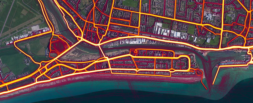
Activity Tracker Maps
bottom of page